

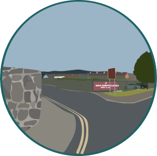
9 – The Orchard Site
Known locally as Googoo’s Hill, this site is currently used as a car park for the nearby King John’s Castle.
12 – Irish Wheelchair Site/St Mary’s Convent
This site once housed St. Mary’s Convent, established by the Sisters of Mercy. It was demolished in the late 1990s and the site has remained largely vacant since then.
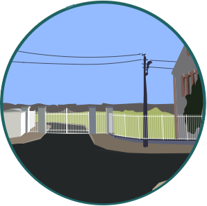
10 – Verdant Place
A small green space that is currently closed off from the public. It is located adjacent to the Toll Cottages and the Toll House on Thomond Bridge.

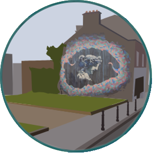
5 – The Parade Park
A small green space adjacent to the Castle Street and the Parade which features an iconic mural of Cranberries’ singer Dolores O’Riordan.
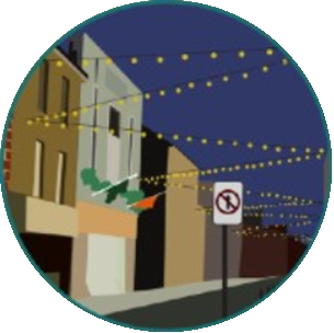
1 – Nicholas Street Public Realm/Shopfronts
One of Limerick’s oldest streets, Nicholas Street is the principal street on King’s Island and links St Mary’s Cathedral to King John’s Castle. In recent years, it has suffered from high levels of vacancy.
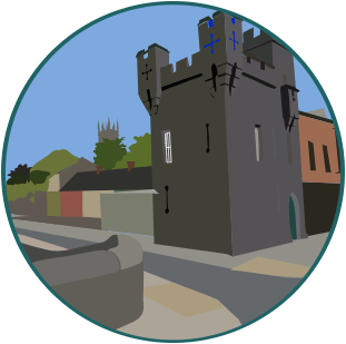
4 – King John’s Castle
King John’s Castle is a 13th-century castle located on the banks of the River Shannon. Although the site dates back to 922 when the Vikings lived on the Island, the castle itself was built on the orders of King John of England in 1200.
8 – Flood Relief Scheme
Major improvements to the flood defence regime are required to prevent re-occurrences of previous flood events on King’s Island. The development of the Public Realm is a major component of the Flood Relief Scheme.
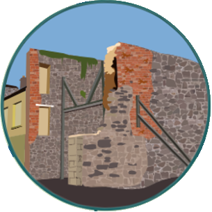
3 – Fireplace Site
In the 1990s, the demolition of existing derelict buildings on Nicholas Street revealed a stone party wall that contains a medieval fireplace and stone corbels. Dating back to the late 15th Century, the fireplace is of archaeological and architectural interest.
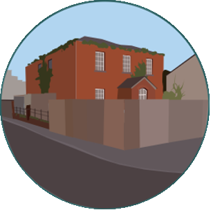
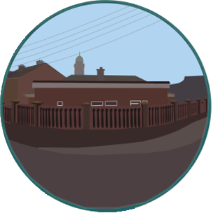
2 – Mary Street Garda Station
Originally a barracks for the Royal Irish Constabulary, the former Mary Street Garda Station is a three-bay two-storey red bricked building located on Mary Street. The building fell out of use in the late 20th Century and a Garda Station operated in temporary accommodation to the rear of the building until 2013.

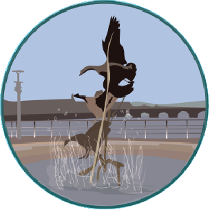
7 – World Class Waterfront
Public realm works stretching along the quayside from the Docks along the central quays to Merchant’s Quay, King John’s Castle and George’s Quay and returning along the north bank of the river Shannon

6 – Sonny’s Corner
This prominent corner site at the junction of Island Road and Athlunkard Street has been used as an informal green space for a number of years. A gable mural provides a pop of colour to passers-by.

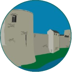
15 – St Mary’s Cathedral
The oldest building in continuous use in all of Limerick City; the cathedral was founded in 1168 by King Domhnall Mór O’Brien. Its bell tower can be seen from all around the city and is one of the city’s most famous landmarks.
11 – Bridge Street
Located close to St Mary’s Cathedral and Creagh Lane School, the site has been vacant for over 20 years. In 2018, Limerick Civic Trust redeveloped the site into a small urban park with an eye-catching mural.
16 – HSE Building
a corner site located on Bishop Street that contains a small health centre.
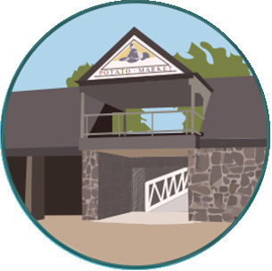
13 – The Potato Market
The Potato Market is an enclosed former market place, overlooking where the Abbey River meets the River Shannon. Established in 1843, the market lasted into the 1940s before it became redundant. The Sylvester O’Halloran bridge connects the market place to the grounds of the Hunt Museum across the river.

14 – Fanning’s Castle
The remains of a five storey tower house, built of roughly squared limestone blocks of varying sizes. It was built c. 1641 by Mayor of Limerick Dominic Fanning.
